


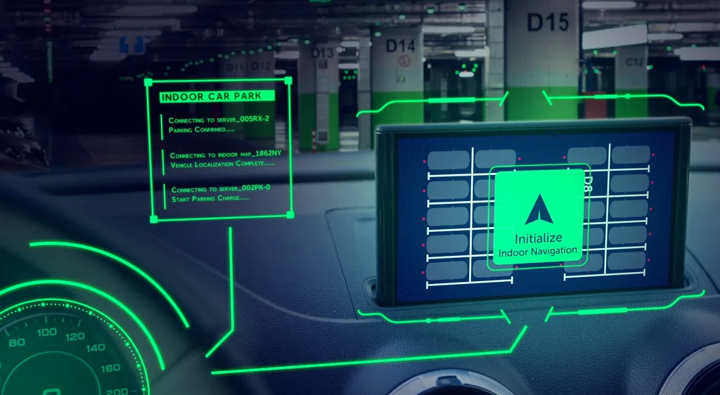
Parkopedia and Hyundai AutoEver have demonstrated what they say is Europe’s first end-to-end in-car indoor navigation system, guiding drivers beyond the car park entrance and all the way to a specific bay or EV charger.
The new Indoor Maps service plugs into a car’s navigation so guidance continues seamlessly inside large, often confusing structures such as multi-storey and underground car parks.
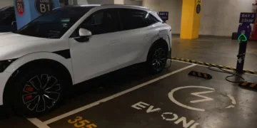
Instead of dropping guidance at the barrier, the system can route to a particular space, charging point or zone without relying on GPS, which typically fails once a vehicle goes indoors.
Parkopedia said the technology is built on high-definition 3D point cloud data rather than low-fidelity floor plans.
That richer map allows the car to “see” indoor environments in much finer detail, including walking routes, accessible bays and payment zones, and is intended to support future features such as automated valet parking and more advanced driver-assist functions.
The company already holds a large inventory of car parks across Europe and has prioritised major mobility hubs.
It has mapped 18 of the 25 busiest airports in Europe, including individual facilities with up to 6,000 spaces, and is now expanding indoor coverage to North America, starting with the San Francisco Bay Area.
To speed up deployment, Parkopedia has developed new tools and AI workflows that automate repetitive tasks.
Computer vision and machine-learning algorithms are used to recognise and log features such as entrances, staircases and lifts, helping to turn raw scan data into navigation-ready indoor maps more quickly.
Duncan Licence, chief product officer at Parkopedia, said: “We are pleased that Hyundai AutoEver has proven that our Indoor Maps service can be successfully integrated into its vehicles and highly valued by its users. We are committed to making cities more livable, with this technology contributing immensely to end-to-end multi-modal travel and seamless mobility across a variety of everyday use cases.”


